Start and finish
Not verified
Walking / Germany
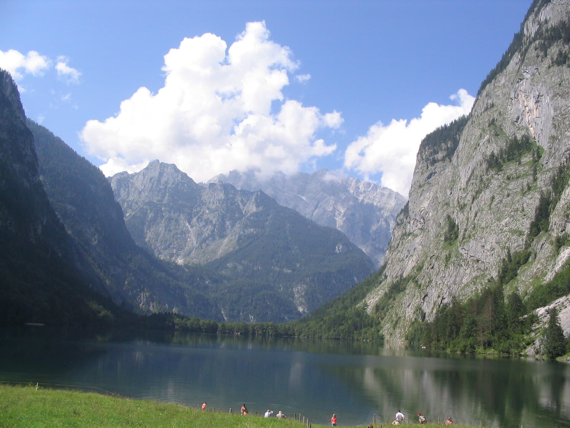
Königssee’s Malerwinkel, Obersee’s western shore and the Klausbachtal walk to Ragertalm: three park-described walks from a fixed base.
ATHVARO / PLANNING GUIDE
Three separate day walks from one accommodation base; an editorial sequence, not a continuous trek or bookable package. For adults; conditions and logistics remain to confirm.
Not verified
12.8 km of selected walking, summed from the three current route pages; excludes boats and transfers.
Source-reviewed information · High confidence in source support · 2026-10-06Bergerlebnis Berchtesgaden · Malerwinkl / GPX ↗Bergerlebnis Berchtesgaden · Obersee / GPX ↗Bergerlebnis Berchtesgaden · Ragertalm / GPX ↗Three walking days, plus arrival and return travel. Published walking times are estimates; allow breaks and extra time for conditions.
Editorial guidance · Moderate confidenceNationalpark Berchtesgaden · easy walks ↗Bayerische Seenschifffahrt · Königssee FAQ ↗Bayerische Seenschifffahrt · visitor information ↗ · Recheck neededNationalpark Berchtesgaden · mountain safety ↗268 m, calculated from the three published day-route ascents; individual GPX files contain no heights.
Source-reviewed information · High confidence in source support · 2026-10-06Bergerlebnis Berchtesgaden · Malerwinkl / GPX ↗Bergerlebnis Berchtesgaden · Obersee / GPX ↗Bergerlebnis Berchtesgaden · Ragertalm / GPX ↗269 m, calculated from the three published day-route descents.
Source-reviewed information · High confidence in source support · 2026-10-06Bergerlebnis Berchtesgaden · Malerwinkl / GPX ↗Bergerlebnis Berchtesgaden · Obersee / GPX ↗Bergerlebnis Berchtesgaden · Ragertalm / GPX ↗Not verified
Use official geometry and current diversions. No track has been invented for this guide.
Open official map / route Nationalpark Berchtesgaden · easy walks ↗No verified elevation samples available. No synthetic profile shown.
Published sections; confirm a connected itinerary, overnight stops and all missing measurements before treating these as daily stages.
| Section | km | Hours | ↑ m | ↓ m | Highest m |
|---|---|---|---|---|---|
| Königssee · Malerwinkel → Königssee Current published circuit figures; confirm that the exact track excludes optional spurs before navigation. Bergerlebnis Berchtesgaden · Malerwinkl / GPX ↗ | 5 | 1.5 | 160 | 161 | — |
| Salet · Obersee Westufer → Salet Day 2 out and back after the boat; stop at the western shore. Bergerlebnis Berchtesgaden · Obersee / GPX ↗ | 2 | 1 | 13 | 13 | — |
| Hintersee · Klausbachhaus → Ragertalm → Klausbachhaus Day 3 out and back via marked path 481. Bergerlebnis Berchtesgaden · Ragertalm / GPX ↗ | 5.8 | 1.5 | 95 | 95 | — |
Published GPX geometry, without a base map; confirm that the supplied variant matches your plan and excludes unwanted detours. This is not current-condition or navigation approval.
This GPX contains no elevation samples. Published ascent/descent figures are shown in the table; no heights have been fabricated.
Distance calculated along the supplied coordinates; published rounded route figures may differ.Bergerlebnis Berchtesgaden · Malerwinkl / GPX ↗Published GPX geometry, without a base map; confirm that the supplied variant matches your plan and excludes unwanted detours. This is not current-condition or navigation approval.
This GPX contains no elevation samples. Published ascent/descent figures are shown in the table; no heights have been fabricated.
Distance calculated along the supplied coordinates; published rounded route figures may differ.Bergerlebnis Berchtesgaden · Obersee / GPX ↗Published GPX geometry, without a base map; confirm that the supplied variant matches your plan and excludes unwanted detours. This is not current-condition or navigation approval.
This GPX contains no elevation samples. Published ascent/descent figures are shown in the table; no heights have been fabricated.
Distance calculated along the supplied coordinates; published rounded route figures may differ.Bergerlebnis Berchtesgaden · Ragertalm / GPX ↗Season guidance is not a forecast or confirmation of openings.
Not verified for this exact route or edition. Confirm before planning.
Not verified for this exact route or edition. Confirm before planning.
Not verified for this exact route or edition. Confirm before planning.
Not verified for this exact route or edition. Confirm before planning.
Not verified for this exact route or edition. Confirm before planning.
Not verified for this exact route or edition. Confirm before planning.
Not verified for this exact route or edition. Confirm before planning.
Not verified for this exact route or edition. Confirm before planning.
Not verified for this exact route or edition. Confirm before planning.
Not verified for this exact route or edition. Confirm before planning.
Not verified for this exact route or edition. Confirm before planning.
Not verified for this exact route or edition. Confirm before planning.
The park lists these in its easy-walk selection. Grades do not replace current path checks. The boat day needs a confirmed last return; no Rinnkendlsteig or longer Obersee detour included.
Editorial guidance · Moderate confidenceNationalpark Berchtesgaden · easy walks ↗Bayerische Seenschifffahrt · Königssee FAQ ↗Bayerische Seenschifffahrt · visitor information ↗ · Recheck neededNationalpark Berchtesgaden · mountain safety ↗Tourism portal’s rating for this individual circuit, not the complete holiday or current conditions.
Bergerlebnis Berchtesgaden · Malerwinkl / GPX ↗The Obersee day requires boat access to Salet. There is no lakeside walking route from Königssee to Salet. Confirm both outward and last return service.
Source-reviewed information · High confidence in source support · 2026-10-06Bayerische Seenschifffahrt · Königssee FAQ ↗Park guidance: sturdy footwear; select and test it for the actual path and conditions.
Editorial guidance · Moderate confidenceNationalpark Berchtesgaden · mountain safety ↗Park guidance: bring rain protection and warm clothing.
Editorial guidance · Moderate confidenceNationalpark Berchtesgaden · mountain safety ↗Editorial check: practise comparable terrain on consecutive days with the actual shoes and pack. Compare recovery with your longest planned day; unresolved fitness or technical gaps mean change the itinerary, not a pass score.
Editorial guidance · Moderate confidenceNKBV · multi-day walking preparation ↗Tour du Mont-Blanc refuge association · preparation framework ↗Optional six-week Athvaro framework below, adapted from the cited preparation principles for already active adults. It is not the operator’s programme; extend preparation or shorten the trip if needed.
Editorial guidance · Moderate confidenceNKBV · multi-day walking preparation ↗Tour du Mont-Blanc refuge association · preparation framework ↗Editorial focus: practise controlled descents, leg strength/balance and gradual pack loading on suitable local terrain. Technical skills need instruction; training does not remove route or weather risk.
Editorial guidance · Moderate confidenceNKBV · multi-day walking preparation ↗Tour du Mont-Blanc refuge association · preparation framework ↗Example week: two easy walks, one familiar-terrain walk and one short strength/balance session. Keep duration within your current capacity; check shoes and pack fit.
NKBV · multi-day walking preparation ↗Tour du Mont-Blanc refuge association · preparation framework ↗Keep two easy walks and one strength/balance session; gradually extend the terrain walk with climbs/descents. Add pack load only as recovery allows.
NKBV · multi-day walking preparation ↗Tour du Mont-Blanc refuge association · preparation framework ↗Test two consecutive walking days with actual kit. Choose the trip from observed recovery and terrain confidence.
Tour du Mont-Blanc refuge association · preparation framework ↗Reduce load: keep two comfortable short walks, with rest around travel. Confirm weather, kit and logistics; do not rush to make up missed preparation.
Tour du Mont-Blanc refuge association · preparation framework ↗The park warns against entering forests in strong wind, thunderstorms or snow-break risk; rockfall can occur near cliffs. Check current notices before every walk.
Source-reviewed information · High confidence in source support · 2026-10-06Nationalpark Berchtesgaden · mountain safety ↗Malerwinkl: never follow the derelict narrow lakeside path with fall risk. Stay on the selected circuit; the optional Rabenwand spur is excluded. Ragertalm shares parts with cyclists.
Source-reviewed information · High confidence in source support · 2026-10-06Bergerlebnis Berchtesgaden · Malerwinkl / GPX ↗Bergerlebnis Berchtesgaden · Ragertalm / GPX ↗For the boat day, set a return deadline from the confirmed last boat; do not rely on an improvised lakeside escape.
Editorial guidance · Moderate confidenceBayerische Seenschifffahrt · Königssee FAQ ↗The National Park instructs mountain-accident callers to dial 112.
Source-reviewed information · High confidence in source support · 2026-10-06Nationalpark Berchtesgaden · mountain safety ↗Emergency dispatch
Nationalpark Berchtesgaden · mountain safety ↗Regional emergency coverage is incomplete. A source card is not a guarantee of current dispatch arrangements.
Links are information handoffs; Athvaro has not confirmed availability, prices or a commercial partnership.
No exact booking destination verified for this itinerary or edition.
Editorial action list; ticking a box does not verify the underlying fact. Boxes reset when the page reloads.
The park lists these in its easy-walk selection. Grades do not replace current path checks. The boat day needs a confirmed last return; no Rinnkendlsteig or longer Obersee detour included.
Nationalpark Berchtesgaden · easy walks ↗Bayerische Seenschifffahrt · Königssee FAQ ↗Bayerische Seenschifffahrt · visitor information ↗ · Recheck neededNationalpark Berchtesgaden · mountain safety ↗Dates record source review, not live trail conditions. Each claim above cites its evidence. Existing overview text has separate review dates.
Named walking variants, not universal safety certification
2026-10-06 · Recheck within 90 daysBoat-dependent access; no lakeside escape path to Salet
2026-10-06 · Recheck within 30 daysCheck current Salet operation directly; future service not guaranteed
2026-10-06 · Recheck within 7 daysPark safety advice and emergency number
2026-10-06 · Recheck within 30 daysPublished circuit metrics and raw GPX; no elevation in downloaded file
2026-10-06 · Recheck within 90 daysWestern-shore return walk and GPX; no elevation in downloaded file
2026-10-06 · Recheck within 90 daysPublished circuit metrics and GPX; no elevation in downloaded file
2026-10-06 · Recheck within 90 daysBasis for editorial endurance, strength, terrain and group-fit guidance; not an official six-week prescription
2026-10-06 · Recheck within 90 daysConsecutive-day/pack/footwear testing principles; Athvaro adaptation for shorter trips
2026-10-06 · Recheck within 90 daysTHE ADVENTURE EXPLAINED
Day 1 Malerwinkel circuit; day 2 boat to Salet and walk to the western Obersee shore; day 3 Hintersee/Klausbachhaus–Ragertalm out and back. Not a continuous trek.
Three walking days, plus arrival and return travel. Published walking times are estimates; allow breaks and extra time for conditions.
The park lists these in its easy-walk selection. Grades do not replace current path checks. The boat day needs a confirmed last return; no Rinnkendlsteig or longer Obersee detour included.
This is a planning preview. Check current conditions, exact variants, overnight stops and exits before booking. No safety or availability approval is implied.
Three separate day walks from one accommodation base; an editorial sequence, not a continuous trek or bookable package. For adults; conditions and logistics remain to confirm.
Explore places & services →