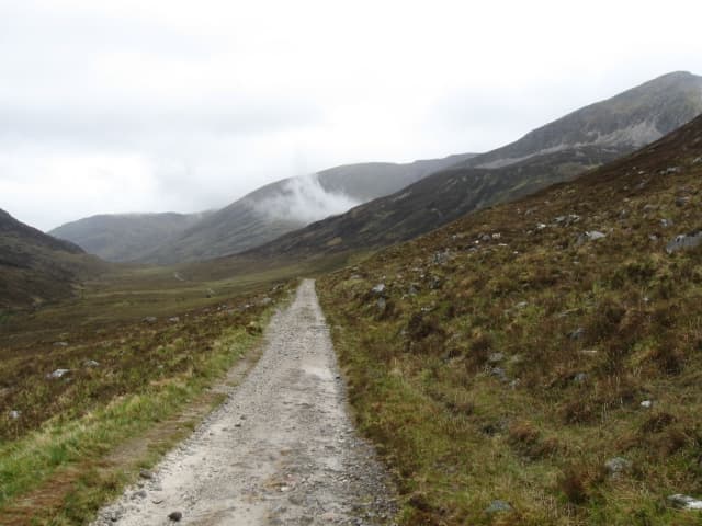
Editorial three-day segment of the WHW; overnight bookings, exact track variant and escape logistics are not confirmed.
Full planning not yet availableLatest source review: 2026-10-16Source confidence varies by field; live conditions and bookings are not confirmed.
Route and day-by-day planning
Inveroran–Kingshouse–Kinlochleven–Fort William. The official final section also describes a High Route via Cow Hill; reconcile your downloaded track with that finish variant.
Season guidance is not a forecast or confirmation of openings.
JanNot verified
Not verified for this exact route or edition. Confirm before planning.
FebNot verified
Not verified for this exact route or edition. Confirm before planning.
MarNot verified
Not verified for this exact route or edition. Confirm before planning.
AprNot verified
Not verified for this exact route or edition. Confirm before planning.
MayNot verified
Not verified for this exact route or edition. Confirm before planning.
JunNot verified
Not verified for this exact route or edition. Confirm before planning.
JulNot verified
Not verified for this exact route or edition. Confirm before planning.
AugNot verified
Not verified for this exact route or edition. Confirm before planning.
SepNot verified
Not verified for this exact route or edition. Confirm before planning.
OctNot verified
Not verified for this exact route or edition. Confirm before planning.
NovNot verified
Not verified for this exact route or edition. Confirm before planning.
DecNot verified
Not verified for this exact route or edition. Confirm before planning.
Is this for me?
Is this for me?
Physically demanding: final section 24 km. Exposed moorland, rough ground and bad weather require preparation. Being healthy is not enough; no safety guarantee.
The route manager lists refreshments at Glencoe Ski Centre/Kingshouse, Kinlochleven and Fort William. Opening hours and drinking-water refill points are not confirmed.
Editorial check: practise comparable terrain on consecutive days with the actual shoes and pack. Compare recovery with your longest planned day; unresolved fitness or technical gaps mean change the itinerary, not a pass score.
Optional six-week Athvaro framework below, adapted from the cited preparation principles for already active adults. It is not the operator’s programme; extend preparation or shorten the trip if needed.
Editorial focus: practise controlled descents, leg strength/balance and gradual pack loading on suitable local terrain. Technical skills need instruction; training does not remove route or weather risk.
Example week: two easy walks, one familiar-terrain walk and one short strength/balance session. Keep duration within your current capacity; check shoes and pack fit.
Mountaineering Scotland warns that Highland reception can be intermittent or absent. This is regional guidance, not a tested coverage map for these stages.
Regional emergency coverage is incomplete. A source card is not a guarantee of current dispatch arrangements.
Official booking and accommodation
Links are information handoffs; Athvaro has not confirmed availability, prices or a commercial partnership.
No exact booking destination verified for this itinerary or edition.
Your departure checklists
Editorial action list; ticking a box does not verify the underlying fact. Boxes reset when the page reloads.
FAQ
Is this guaranteed safe for every healthy adult?
Physically demanding: final section 24 km. Exposed moorland, rough ground and bad weather require preparation. Being healthy is not enough; no safety guarantee.
Consecutive-day/pack/footwear testing principles; Athvaro adaptation for shorter trips
2026-10-06 · Recheck within 90 days
Planning details still to confirm (39)
Ascent
Descent
Technical difficulty
Navigation
Resupply
Transport, parking and transfers
Weather and seasonal risks
When to book
Permits and reservations
Dated indicative costs
Solo, guided or self-guided
Required gear
Optional gear
Seasonal gear
Footwear
Backpack
Clothing layers
Safety equipment
Offline navigation and powerbank
Fitness level
Experience required
Acclimatisation
Objective hazards
Human factors
Turnaround criteria
Verified escape routes
Bad-weather alternatives
Insurance questions
Access rules and leave no trace
Dogs
Family suitability
Common mistakes
Attributed expert advice
Complete stage measurements
Connected overnight plan
Verified twelve-month season matrix
All regional emergency contacts
Verified booking destinations
Sourced elevation samples
THE ADVENTURE EXPLAINED
What is Three days on the Highland Way?
Walk Inveroran–Kingshouse–Kinlochleven–Fort William. This editorial three-day itinerary uses the official route sections; it excludes a Ben Nevis summit ascent.
Distance & time
Three walking days, plus arrival and return travel. Published walking times are estimates; allow breaks and extra time for conditions.
How difficult?
Physically demanding: final section 24 km. Exposed moorland, rough ground and bad weather require preparation. Being healthy is not enough; no safety guarantee.
What does preparation involve?
This is a planning preview. Check current conditions, exact variants, overnight stops and exits before booking. No safety or availability approval is implied.
Prepare
Check current official route notices and weather before committing.
Match every day to the least prepared adult and test consecutive walking days.
Confirm accommodation, transport and a realistic retreat plan.