Start and finish
Milngavie → Fort William, usually south to north.
Source-reviewed information · High confidence in source support · 2026-10-06West Highland Way · route sections ↗Walking / Scotland
Walk Scotland's long-distance classic from Milngavie to Fort William, one manageable stage at a time.
ATHVARO / PLANNING GUIDE
Official south-to-north route; eight sections are not automatically eight booked walking days.
Milngavie → Fort William, usually south to north.
Source-reviewed information · High confidence in source support · 2026-10-06West Highland Way · route sections ↗154 km; official section distances are rounded.
Source-reviewed information · High confidence in source support · 2026-10-06West Highland Way · route sections ↗Official FAQ: typically 6–7 days; adjust to ability.
Source-reviewed information · High confidence in source support · 2026-10-06West Highland Way · official FAQ ↗Not verified
Not verified
Devil’s Staircase: about 550 m; the same official page lists a 551 m height range. Rounded source values differ.
Source-reviewed information · High confidence in source support · 2026-10-06West Highland Way · Kingshouse to Kinlochleven ↗Loch shores, moorland and mountain paths; north Loch Lomond can be slow and rough.
Source-reviewed information · High confidence in source support · 2026-10-06West Highland Way · route sections ↗West Highland Way · itinerary guidance ↗Use official geometry and current diversions. No track has been invented for this guide.
Open official map / route West Highland Way · route sections ↗No verified elevation samples available. No synthetic profile shown.
View the official elevation profile ↗Published sections; confirm a connected itinerary, overnight stops and all missing measurements before treating these as daily stages.
| Section | km | Hours | ↑ m | ↓ m | Highest m |
|---|---|---|---|---|---|
| Milngavie → DrymenWest Highland Way · route sections ↗ | 19 | — | — | — | — |
| Drymen → RowardennanWest Highland Way · route sections ↗ | 24 | — | — | — | — |
| Rowardennan → InverarnanWest Highland Way · route sections ↗ | 22.5 | — | — | — | — |
| Inverarnan → TyndrumWest Highland Way · route sections ↗ | 19.5 | — | — | — | — |
| Tyndrum → InveroranWest Highland Way · route sections ↗ | 14.5 | — | — | — | — |
| Inveroran → KingshouseWest Highland Way · route sections ↗ | 16 | — | — | — | — |
| Kingshouse → KinlochlevenWest Highland Way · route sections ↗ | 14.5 | — | — | — | — |
| Kinlochleven → Fort WilliamWest Highland Way · route sections ↗ | 24 | — | — | — | — |
Season guidance is not a forecast or confirmation of openings.
Not verified for this exact route or edition. Confirm before planning.
Not verified for this exact route or edition. Confirm before planning.
Not verified for this exact route or edition. Confirm before planning.
Not verified for this exact route or edition. Confirm before planning.
Not verified for this exact route or edition. Confirm before planning.
Not verified for this exact route or edition. Confirm before planning.
Not verified for this exact route or edition. Confirm before planning.
Not verified for this exact route or edition. Confirm before planning.
Not verified for this exact route or edition. Confirm before planning.
Not verified for this exact route or edition. Confirm before planning.
Not verified for this exact route or edition. Confirm before planning.
Not verified for this exact route or edition. Confirm before planning.
Kingshouse–Kinlochleven moorland is exposed in poor weather. This does not grade every section.
Source-reviewed information · High confidence in source support · 2026-10-06West Highland Way · Kingshouse to Kinlochleven ↗Waymarked; map-and-compass skills still required.
Source-reviewed information · High confidence in source support · 2026-10-06West Highland Way · official FAQ ↗Controlled dogs allowed; check Conic Hill lambing exclusions and accommodation.
Source-reviewed information · High confidence in source support · 2026-10-06West Highland Way · official FAQ ↗Solo walking is possible; this does not establish your readiness.
Source-reviewed information · High confidence in source support · 2026-10-06West Highland Way · official FAQ ↗Official guide identifies bus/train options; times, parking and transfers remain unverified.
Source-reviewed information · High confidence in source support · 2026-10-06West Highland Way · itinerary guidance ↗Book overnight stops ahead; no exact booking window verified.
Source-reviewed information · High confidence in source support · 2026-10-06West Highland Way · official FAQ ↗A route-specific training plan is not verified. A generic plan cannot establish readiness for this adventure.
November–March may bring winter conditions; specialist skills and equipment needed.
Source-reviewed information · High confidence in source support · 2026-10-06West Highland Way · official FAQ ↗Call 999 or 112; ask for Police and Mountain Rescue. Give position, casualties and callback number.
Source-reviewed information · High confidence in source support · 2026-10-06Mountaineering Scotland · calling for help ↗Highland reception can be absent; emergency SMS requires advance registration.
Source-reviewed information · High confidence in source support · 2026-10-06Mountaineering Scotland · calling for help ↗Leave no trace; Loch Lomond camping byelaws apply March–September in designated zones.
Source-reviewed information · High confidence in source support · 2026-10-06West Highland Way · official FAQ ↗Police and Mountain Rescue
Mountaineering Scotland · calling for help ↗Police and Mountain Rescue
Mountaineering Scotland · calling for help ↗Links are information handoffs; Athvaro has not confirmed availability, prices or a commercial partnership.
No exact booking destination verified for this itinerary or edition.
Editorial action list; ticking a box does not verify the underlying fact. Boxes reset when the page reloads.
No. The route manager says section lengths need adapting to fitness and overnight stops.
West Highland Way · route sections ↗Dates record source review, not live trail conditions. Each claim above cites its evidence. Existing overview text has separate review dates.
Devil’s Staircase height and section exposure; not current conditions
2026-10-06 · Recheck within 90 daysPublished route and rounded section distances
2026-10-06 · Recheck within 90 daysSeason, dogs, navigation and rules; confirm current restrictions
2026-10-06 · Recheck within 90 daysItinerary options, terrain and transport guidance
2026-10-06 · Recheck within 90 daysScottish emergency procedure and communication limits
2026-10-06 · Recheck within 30 daysTHE ADVENTURE EXPLAINED
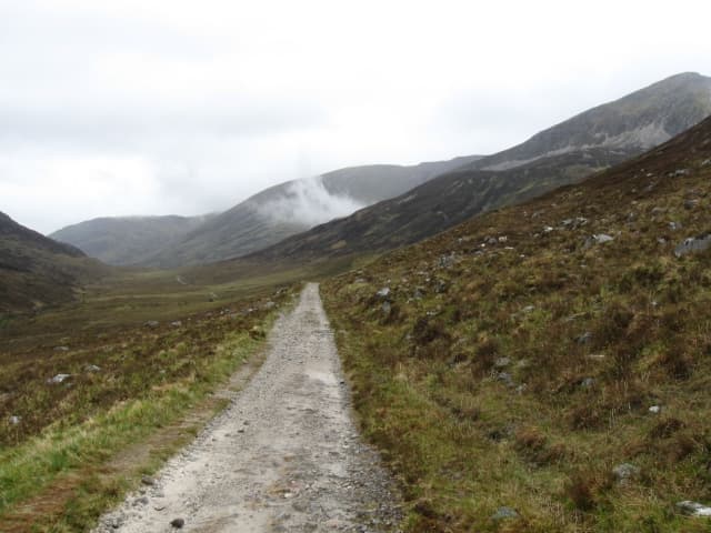
A waymarked long-distance walk through Scotland from Milngavie, near Glasgow, to Fort William. It passes lochs, glens and open Highland terrain, with villages and overnight options along the way.
About 154 km in total; many walkers allow roughly 6–8 walking days, or choose a shorter section.
Moderate overall for a prepared walker, but consecutive long days, uneven ground and Scottish rain or wind can make stages tiring.
Set a comfortable daily distance, then match accommodation and transport to it. Check route notices and the forecast before each stage.
Milngavie is reachable from Glasgow by train. Plan your return from Fort William or walk just a section if time is limited.
Explore places & services →